Why do most maps put north at the top?
An Akkadian map from about 2300 BCE has east on top, Han Chinese maps put south up, and in 1979 an Australian redrew the world upside down on purpose.
▶ Start the storyMostly out of habit, a convention inherited from the ancient world rather than a rule of geography. Ptolemy's atlas Geographia included the practice of orienting maps with north at the top and east to the right, and that is now an almost universal custom: modern maps generally have north up, and maps drawn another way usually carry an arrow pointing to true north.
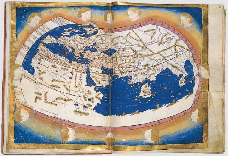
For most of history, though, people chose all sorts of directions. One of the earliest maps with a known orientation, an Akkadian clay tablet from around 2300 BCE, has east at the top. In China, maps of the Qin state put north at the top, but the later Han dynasty maps found at Mawangdui put south there. In medieval Europe, mappae mundi were drawn facing all four directions and many T and O maps put east on top. In 1647, Sadiq Isfahani of Jaunpur compiled a 32-sheet atlas oriented towards the south, as Islamic works of the era were.
The habit is not neutral to everyone. The Guyanese politician Shridath Ramphal argued that north-up maps could encourage an implicit sense that northern countries are superior. In 1979, the Australian Stuart McArthur answered with a south-up world map that put his country in a position of prominence, titled 'McArthur's Universal Corrective Map of the World'.
Quiz me
0/3
Recap
Nothing about Earth puts north 'up': modern maps follow a convention going back to Ptolemy.
Surprising fact · In 1979, Stuart McArthur published a deliberately south-up world map, 'McArthur's Universal Corrective Map of the World'.
Sources (5)
No source, no claim. Every fact in this lesson (13 claims) cites at least one of these.