Why is one small village split into dozens of pieces of two countries?
In Baarle, the Belgian–Dutch border runs through living rooms, and your nationality can depend on where your front door is.
▶ Start the storyBecause a medieval patchwork of land deals was frozen into a modern border. Baarle looks like one ordinary village in the south of the Netherlands, but it is really two municipalities: Dutch Baarle-Nassau and Belgian Baarle-Hertog. The Dutch town surrounds 22 little islands of Belgium, and inside the two biggest Belgian islands sit seven Dutch islands. Baarle-Hertog alone is made of 26 separate parcels of land.
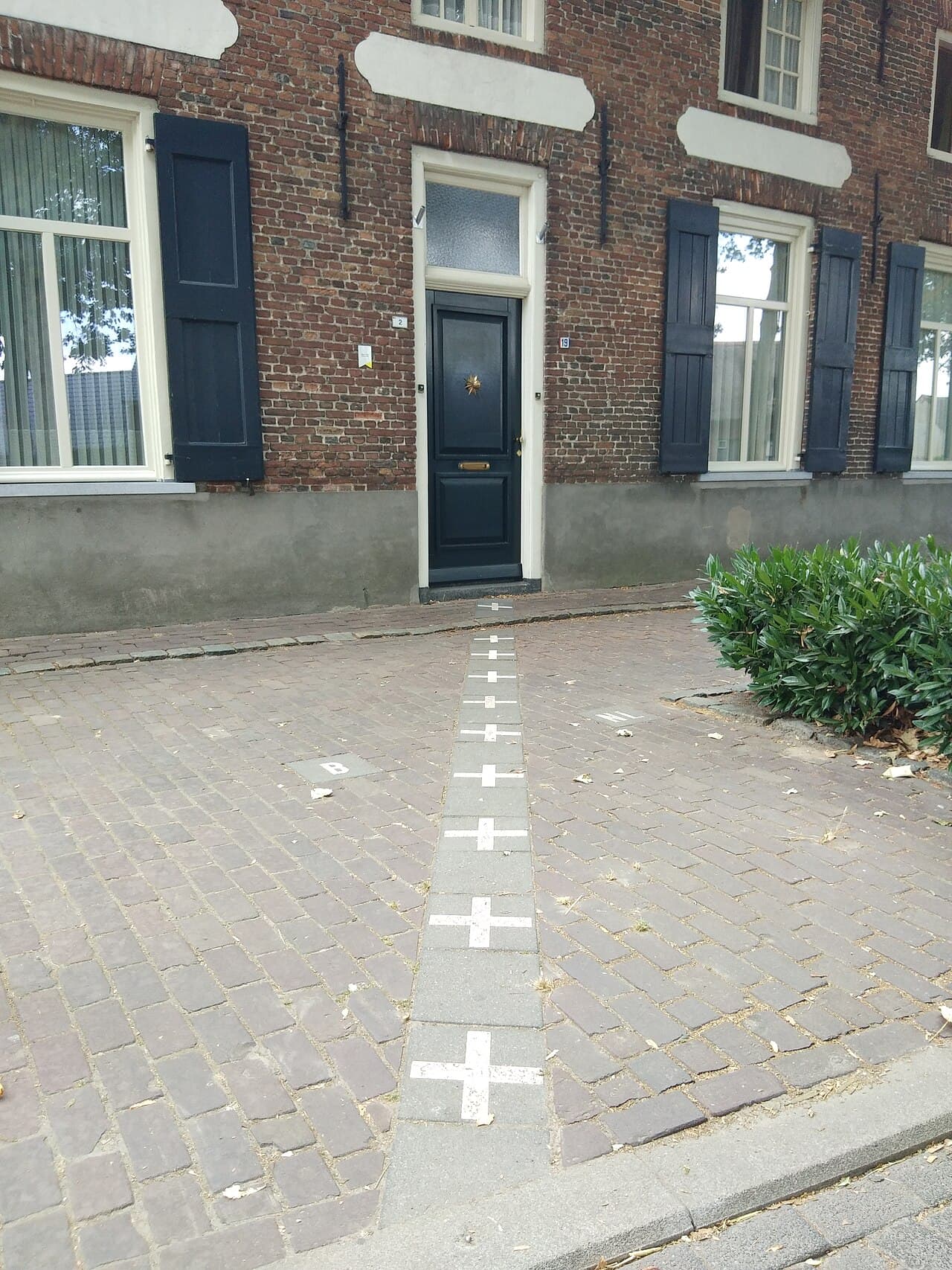
The tangle goes back centuries, to treaties, swaps and sales between the Lords of Breda and the Dukes of Brabant. When Belgium and the Netherlands drew their border at the Treaty of Maastricht in 1843, they could not agree on a line here, so they simply followed an 1841 land survey of who owned each plot. That survey roughly matched how the land had been divided in 1198.
Living inside the puzzle is wonderfully odd. The border is painted across streets and even runs through houses. A house's nationality often depends on which country its front door opens onto, and some owners have moved their door for tax reasons. When Dutch restaurants had to close earlier than Belgian ones, customers at border restaurants just moved to a table on the Belgian side.
The puzzle was not even finished until recently: in 1995, a parcel belonging to no country at all was found and handed to Belgium as its 22nd enclave.
Quiz me
0/3
Recap
Baarle's crazy border is a medieval patchwork of land deals frozen into an international frontier in 1843.
Surprising fact · A house's nationality can depend on which country its front door opens onto, and some owners have moved their doors.
Sources (3)
No source, no claim. Every fact in this lesson (18 claims) cites at least one of these.